

Tropical Storm No. 27 'Koto' weakens into a tropical depression


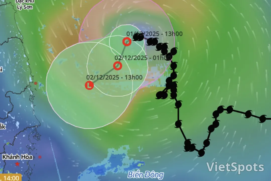
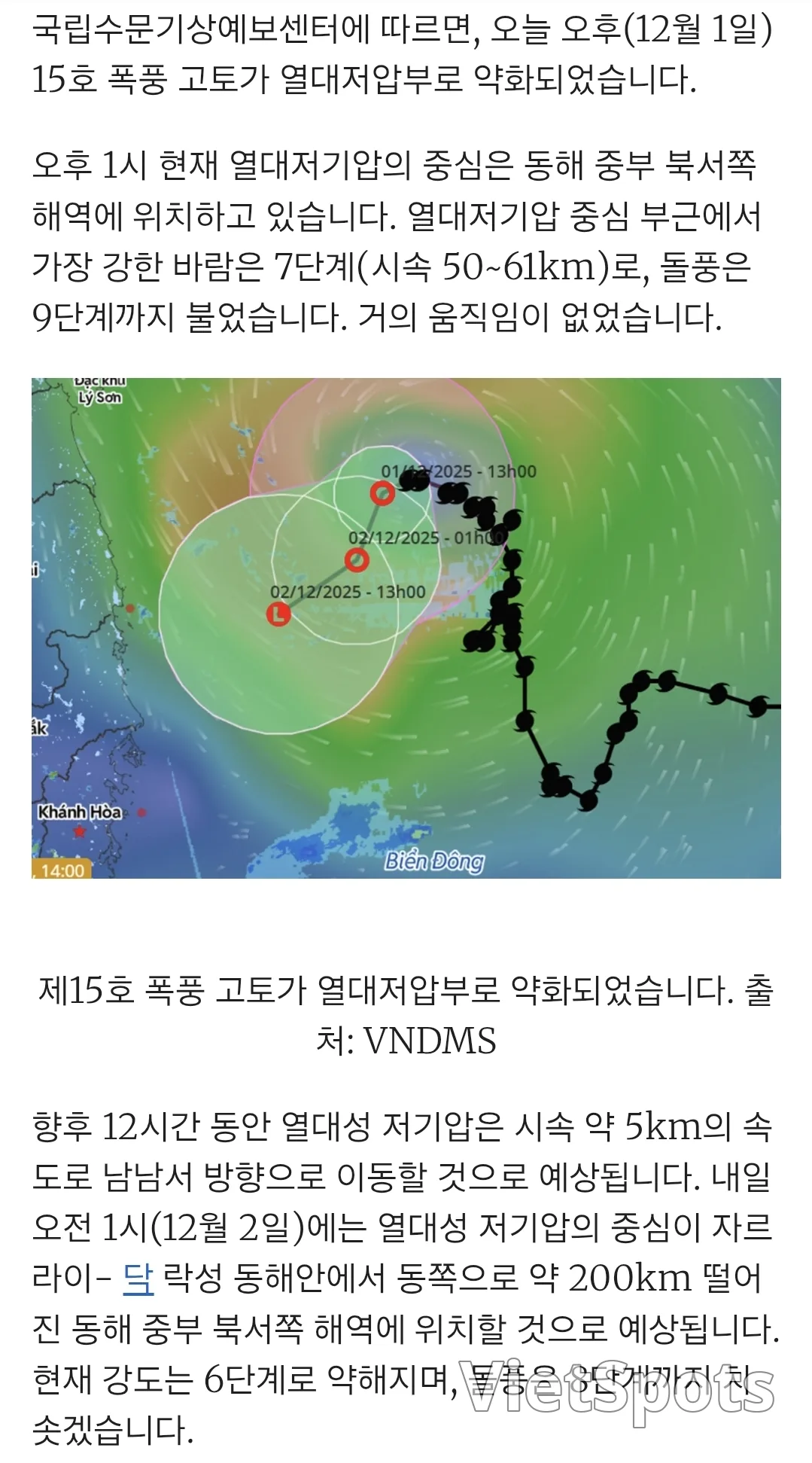
✅ Typhoon 'Koto' Real-time Summary 1) Current Status According to an announcement by Vietnam's National Center for Hydro-Meteorological Forecasting, on the afternoon of December 1st, Typhoon Koto weakened into a tropical depression. The center of the tropical depression is located in the sea area northwest of the central East Sea, and it is showing almost no movement. Near the center, the maximum wind speed is 50–61 km/h (Force 7), and gusts up to level 9 have been observed. 2) Future movement Expected to move toward the south-southwest at about 5km/h for 12 hours. At 1 AM on December 2, it is expected to be located about 200km east of Gia Lai–Dak Lak province, over the sea. Afterward, it is likely to weaken further, move southwestward, and dissipate into a low-pressure area. 4) Impact on Vietnam regions (including Da Nang and Nha Trang) Due to tropical low-pressure residual circulation + cold air intensification + upper-level easterly wind belt influence, between the night of December 2–5, → Quang Tri to Da Nang → Quang Ngai to Dak Lak → Khanh Hoa (including Nha Trang) widespread moderate to heavy rain is forecast. 5) Sea impact In the sea area northwest of the East Sea ~ near Gia Lai–Dak Lak province: wind force 64m, very rough seas. Vessels in this area Danger due to possible strong winds, high waves, and whirlwinds. 6) Additional outlook During December 2025, there is a possibility of 1–2 additional storms or tropical depressions occurring in the East Sea. During the first half of December, the central coast of Vietnam (Quang Tri to Khanh Hoa) may experience widespread heavy rain. Source: VietNamNet
Travel Vietnam with VietSpots, in English
- 🎁 Sign up and get 16 Welcome Pack coupons — e.g. Motorbike Rental 45%
- 👑 Member tier discount up to 15% on site (Silver 5% · Gold 15%)
- 🛂 Auto-fill arrival card📶 Compare lowest eSIM prices🚻 Find toilets
Comments