

Huế seen from an airplane in 1932 — and why you still get lost in the Imperial City



In 1932, a French pilot flew over Hue and took this photo. Seen from above, the Imperial Citadel looks so neat, symmetrical, and clear that it seems almost impossible to get lost in it.
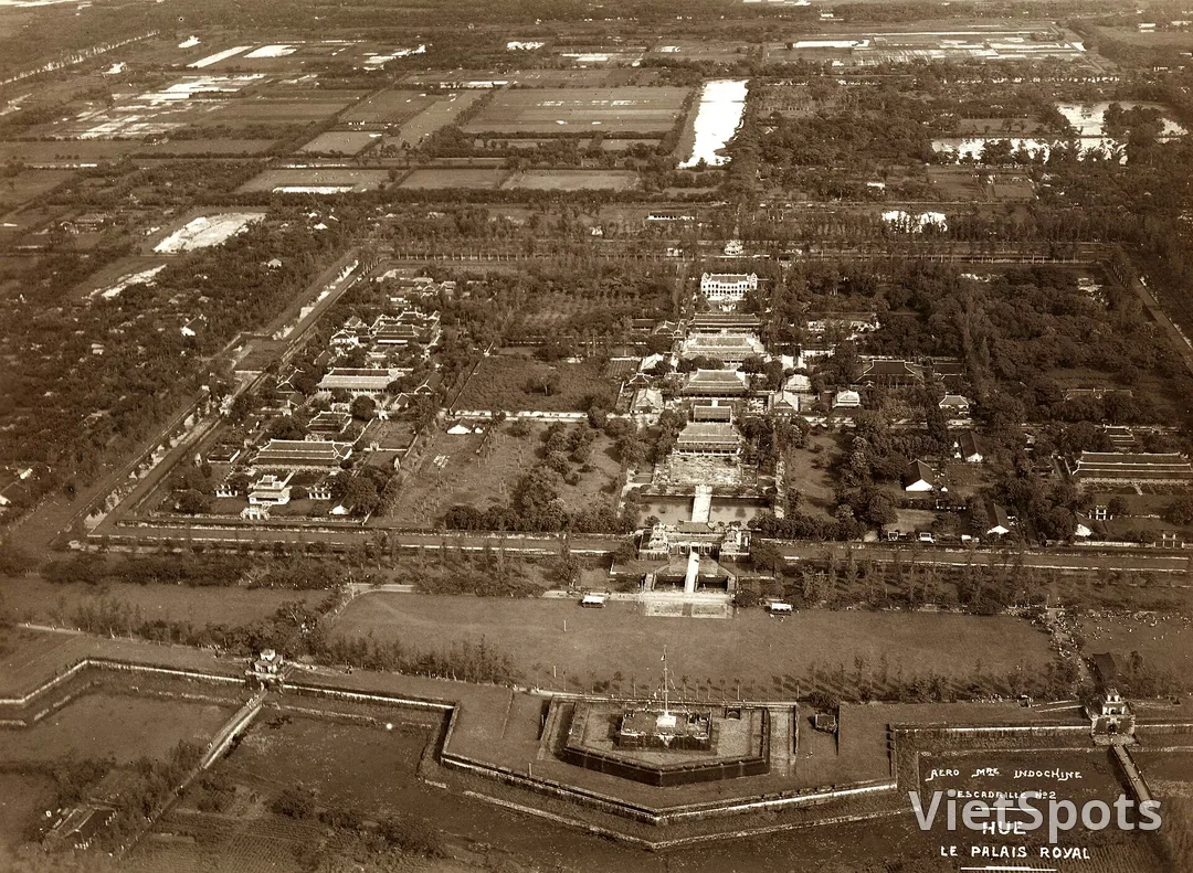
Then you come down to the ground.
The Imperial City covers about 36 hectares. The map at the gate is beautifully drawn and completely useless, because it's viewed from above — while you're standing in the middle of a courtyard, surrounded by four yellow walls that all look exactly the same, and every path leads to yet another gate that's also yellow.
A few survival tips:
The main axis is your lifeline—the Ngọ Gate, Thái Hoà Palace, and Forbidden City all line up on a straight north-south line. If you get lost, find your way back to this axis. Wear flat shoes. Tiled courtyard, scorching sun, and you'll walk much more than planned—about three times as much. • Go early in the morning. From 10 o'clock onwards, that sprawling courtyard turns into a frying pan. • Bring water. Inside there are just a few shops, and the prices are exactly what you'd expect.
A comforting thought: the photo above shows that most of the buildings in the area used to be far denser than they are now. War took away a great deal. So if you already find the Imperial City spacious — it used to be even more so.
Book Activity in Da Nang — in English on VietSpots
- 🎁 Sign up and get 15 Welcome Pack coupons — e.g. Motorbike Rental 45%
- 👑 Member tier discount up to 15% on site (Silver 5% · Gold 15%)
- 🛂 Auto-fill arrival card📶 Compare lowest eSIM prices🚻 Find toilets






Comments